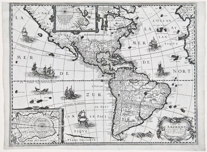

TAVERNIER, Melchior (1564-1641)
Carte de l'Amerique corrigee et augmentee dessus Toutes les aultres cy devant faictes par P. Bertius
[Paris: 1627]. Copper-engraved map, insets of polar regions. Sheet size: 16 x 21 3/8 inches.
Scarce first state of Tavernier's separately-issued map of North America, including insets of the Arctic and Antarctic regions.
In 1627, Tavernier, the most important mapseller and publisher in France, published a set of the four continents after Bertius, though possibly without his permission. Although crediting Bertius, the map more closely follows the Hondius mapping of 1618, with the completed northwest coast line, similar mapping of the Great Lakes and similar decorative ships and sea monsters (though without the decorative surround). However, unlike the Hondius map, here the southern coast of Tierra del Fuego is completed, as per the Bertius map of 1624. The map was first issued separately, and then issued in Tavernier's Theatre Geographique. The present example is the rare, separately-issued first state; the subsequent issue published after 1640 included additional toponyms, such as "Neuf Amsterdam" (i.e. New York), "Pleymouth", "Accadie" and others.
Burden, The Mapping of North America 218; Wagner, Cartography of the Northwest Coast 335.
Item #25760
Price: $2,500.00