
[MITCHELL, S. Augustus]
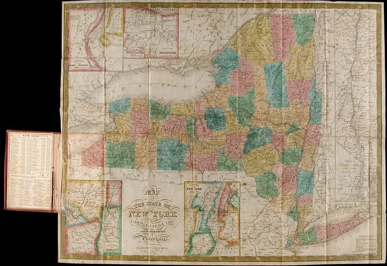
Map of the State of New York Compiled from the Latest Authorities
Philadelphia: S. Augustus Mitchell, 1834. Full period color, 17 x 20 1/2 inches, folding into gilt-stamped brown leather covers. Statistical table laid down on inside front cover. Five insets (see below). Minor repairs.
This is the second pocket map edition of D. H. Vance's map of New York State with the imprint of S. Augustus Mitchell. Mitchell had purchased the plate from Anthony Finley in 1831, removed Vance's name, added a new border, and included it in his edition of the A New American Atlas (1831). The map was first issued as a pocket map by Mitchell in 1832. With the 1832 edition, Mitchell replaced the inset, "Profile of the Erie Canal," with four insets: "Vicinity of Albany," "Vicinity of New York," "Vicinity of the Falls of Niagara" and "Vicinity of Rochester." With this 1834 edition the statistical table at right was replaced by an inset "Map of the Hudson River." Numerous new towns are present throughout, and distances in miles along roads between towns have been added. New York's first railroads are also included for the first time. The title has been moved from the upper left to the lower left corner. This edition is not listed in Rumsey nor in Phillips.
Item #3245
Price: $450.00