
HOPKINS, G. H
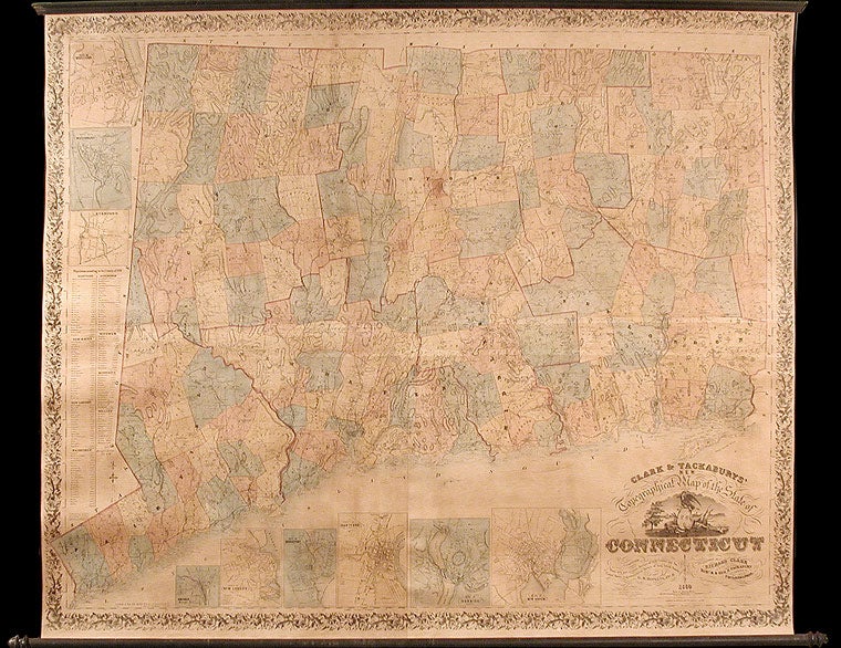
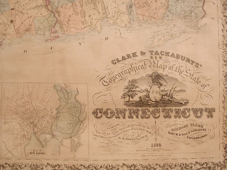
Clark & Tackaburys New Topographical Map of the State of Connecticut. Compiled from New and Accurate Surveys of each County, and the United States Trigonometrical Surveys of Long Island Sound.
Philadelphia: Clark & Tackabury, 1860. Copper-engraved wall map, with full original colour, expertly repaired, backed with new linen, trimmed in blue cloth, on contemporary rollers, in very good condition. Sheet size: 53 x 68 1/2 inches.
A very fine wall map of the state of Connecticut, based on the latest surveys.
During the 1850s, Richard Clark published a large number of wall maps based on actual survey of Connecticut towns and counties. Many of those had been the work of the distinguished Philadelphia surveyor, G. H. Hopkins, who was responsible for this accomplished general map. Each township in the state is individually coloured, and many schools, churches, cemeteries, post offices, stores, mines, mills, factories, iron works, etc., are located throughout rural Connecticut. Nine inset maps give detailed plans of the cities of Middletown, Waterbury, Stamford, Norwalk, New London, Bridgeport, Hartford, Norwich, and New Haven. A table gives population statistics for Connecticut's eight counties, and for the major towns and cities in each county. Grist mills and sawmills are shown, as are railroads and common roads. The mapping of the Connecticut coastline is especially fine, giving depths for the entire stretch of Long Island Sound, and showing several islands lying off the coast. This map is the second edition, the first having been printed in 1859, and is an excellent detailed look at Connecticut on the eve of the Civil War. Not in Phillips' America.
Rumsey 141; Thompson 181; Ristow, p.388 (ref).
Item #5639
Price: $2,750.00